See our Instagram post here!
Imagine a morning in the life of a 1930s Sacramento resident. Your journey begins outside your home on 25th and F where the ground floor is also home to a cafe with your favorite creamed chipped beef on toast, what a delectable indulgence. It’s a bit expensive, so you grab breakfast across the street instead. Halfway through breakfast you have a chance encounter with a friend and promptly get caught up in conversation, probably talking about the gold rush or something. Moments later you hear a streetcar approaching which prompts you to check your old-timey pocket watch and realize that you’re running late! After gathering your coat and hat (and monocle), you rush back into the street to flag down the streetcar. Dang, you missed it! Not to worry, here’s the next, a few minutes later. You take the line 1 to the line 10, then hop off at Southside Park. 15 minutes later, you’ve made it clear across town. Your workplace is now only two blocks away but you decide to take the scenic walk through the park.
A brief history of Sacramento
For most its history, public transit has been used to serve dense and mixed-use urban areas all around the world. In 1850, Sacramento was just a small settlement of about 25 city blocks: a “walking city.” Only 10 years later it was already being served by horse-drawn streetcars, and another 10 years brought rail-suppprted streetcars. Public transit provided the connectivity which enabled the city of Sacramento to grow during its first few decades of existence.
Until the mid 1940s, at least 90% of Sacramento residents were within a 1/4 mile walk of a high-frequency streetcar line. The network served a relatively dense population and predominantly mixed-use urban landscape:
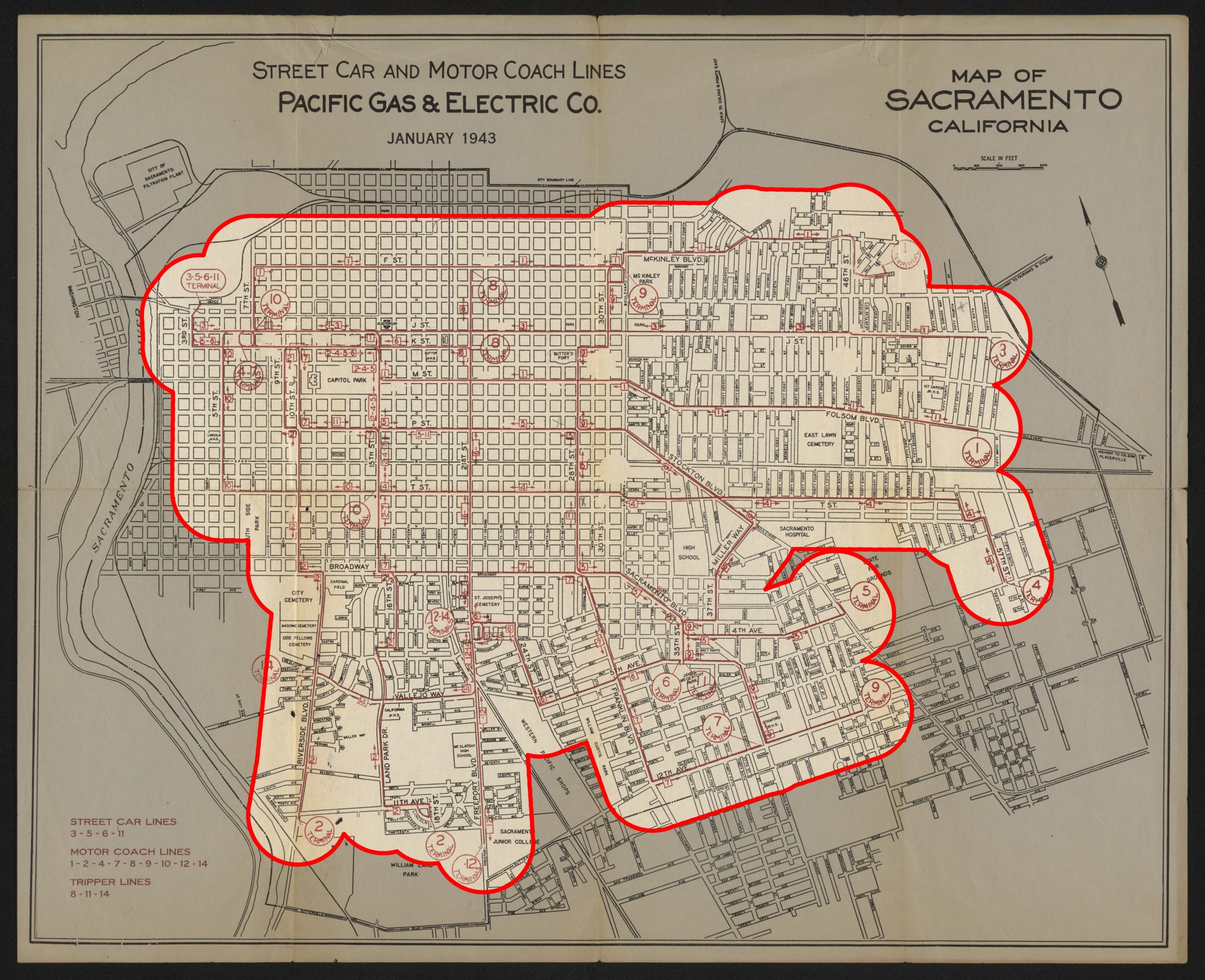
Map © Sacramento Public Library
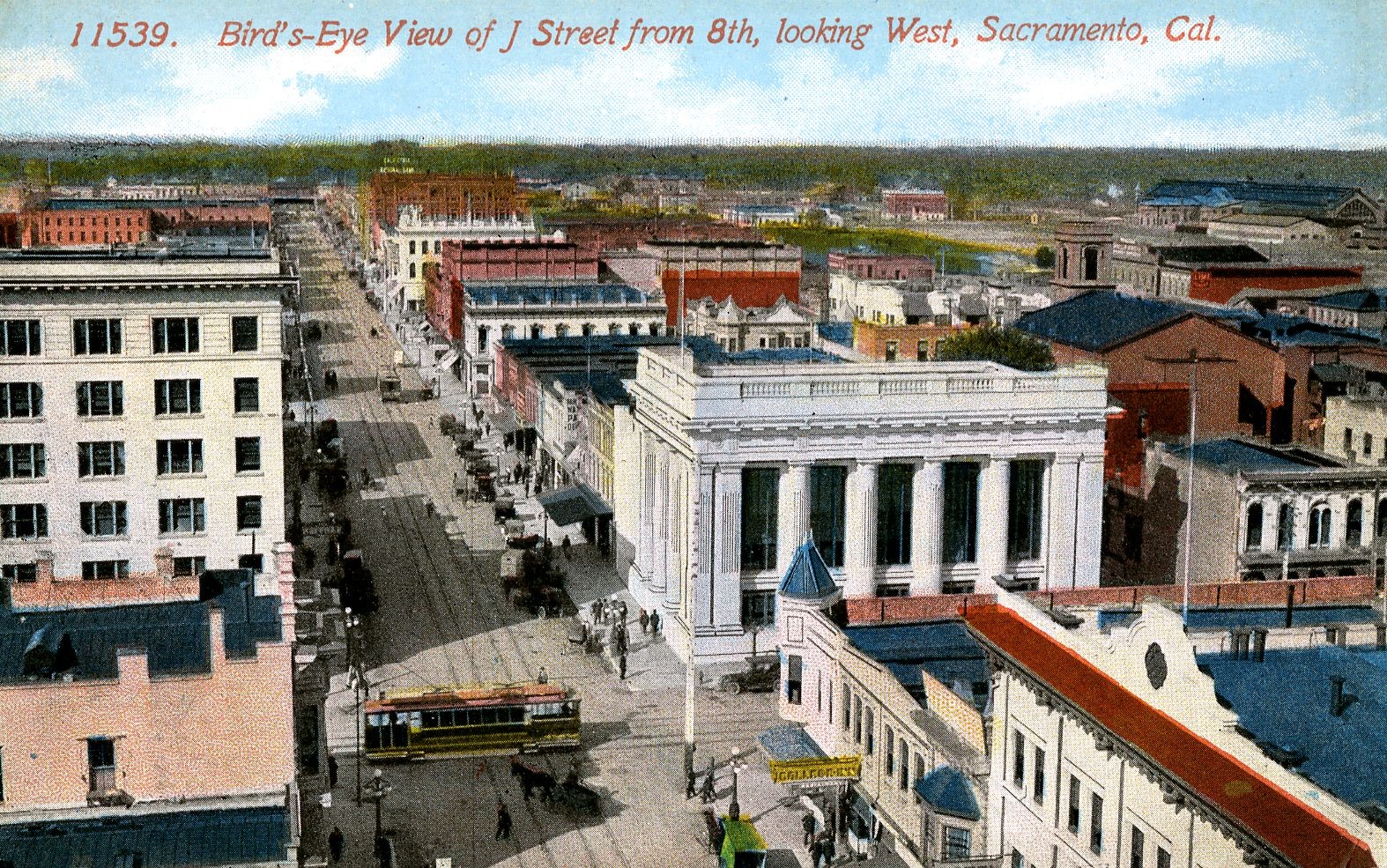
Up until this point in history, streetcars served almost every Sacramentan for most of its existence. Nearly four generations of people knew only a version of Sacramento well-served by public transit. Streetcars even served areas where, today, there is no trace left. The “streetcar suburb” of Oak Park was the recipient of the first overhead electric streetcars, a modern marvel compared to the more traditional horse-drawn streetcars.
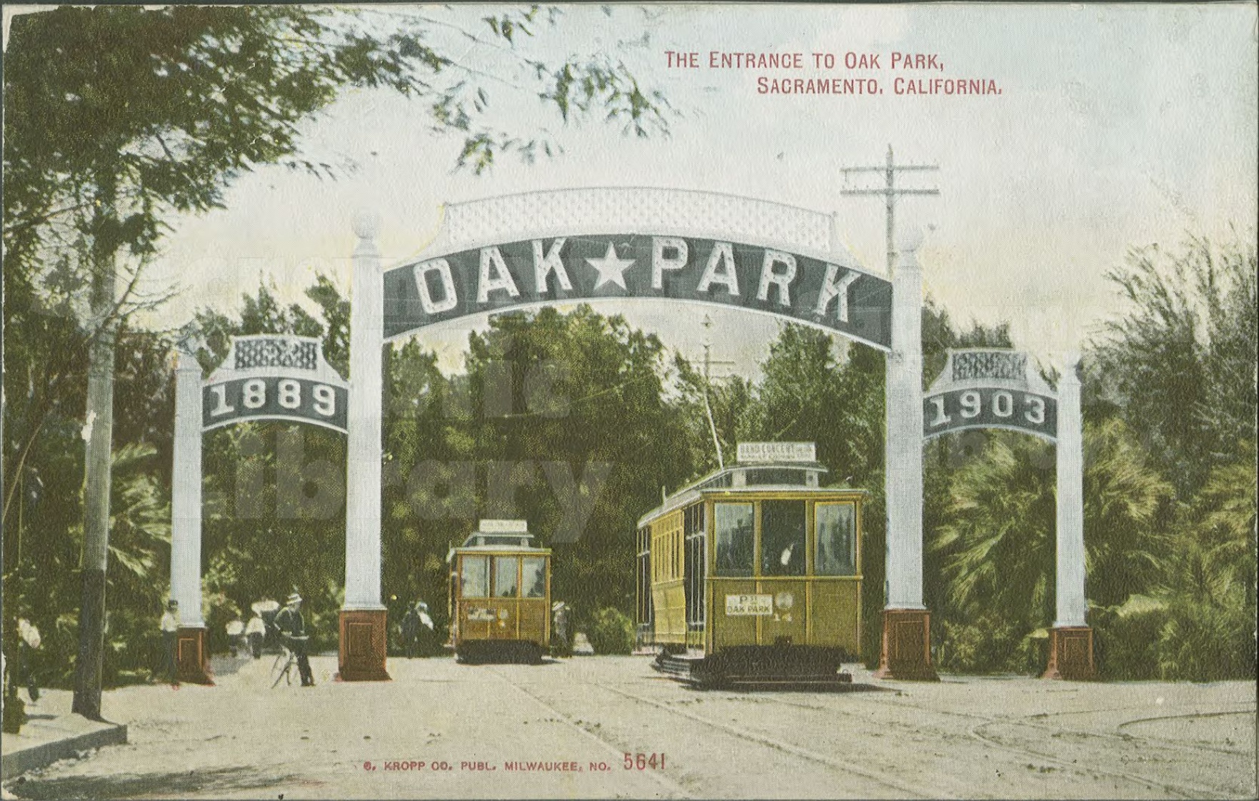
© Sacramento Public Library
Importantly, the development patterns seen along streetcar lines resemble what we would today describe as transit-oriented, which is to say they typically were dense and mixed-use. Lots were narrow, buildings attached to adjacent buildings, office/residential units were mixed and stacked above street-facing businesses, and parking was exclusively on-street. These were places of work, home, chore, and leisure, with enhanced connectivity to the rest of the city.

Image Public Domain
Sacramento was essentially one big transit-oriented development during this time period. However, by the mid 1940s, this would come to an end.
Sacramento forgot how to build a transit city
Gone are the days of public transit covering the majority of the city. Today, rail transit covers less than 5% of the built-up area:
Instead, a network of urban freeways, stroads, and parking lots have substantial coverage citywide. 80 years after petroleum and automotive interests dismantled the streetcar network, and after 80 years of making fiscally irresponsible planning decisions, Sacramento today primarily builds transit to serve cars rather than to serve people and destinations.
However, the main problem is not transit coverage area; it is the poor planning which has resulted in transit stations almost always completely surrounded by incompatible land uses. I would roughly bucket light rail stations into three categories:
- Light rail stations made inaccessible by a sea of parking.
- Light rail stations completely surrounded by low density.
- Light rail stations surrounded by industrial land uses.
In reality, the stations are often subjected to a combination of all three poor land uses. This time, unfortunately, the whole is not greater than the sum of its parts.
1. Light rail stations made inaccessible by a sea of parking
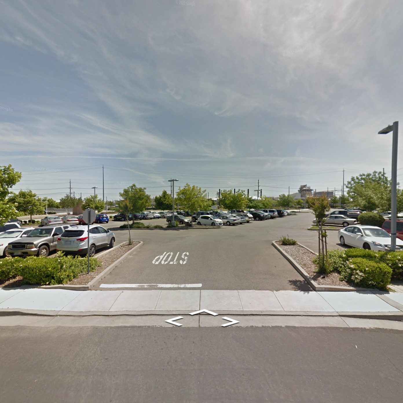
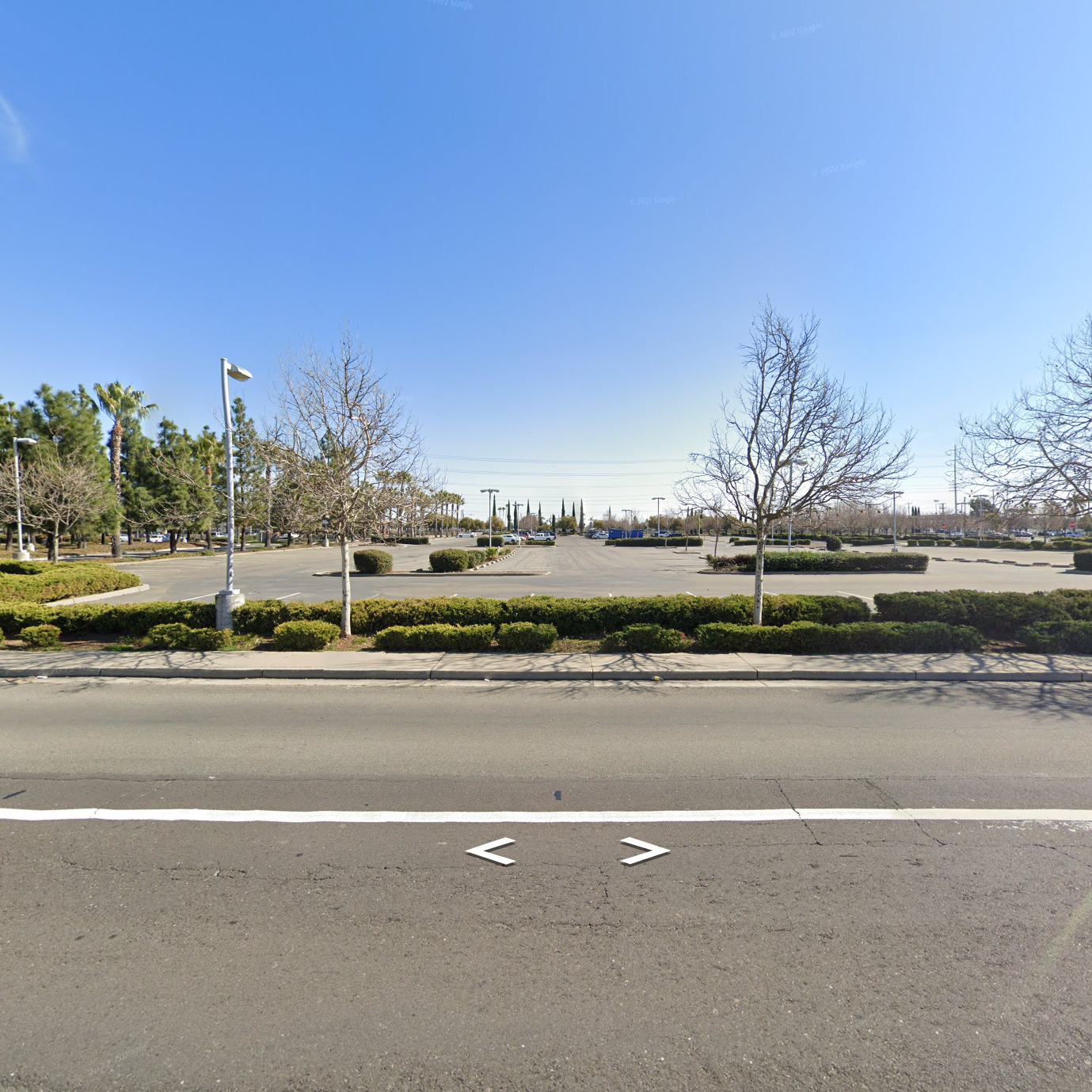
Images © Google
In these places, public transit exists to serve auto-based development patterns, rather than offer a true alternative to driving. Sometimes providing over 900 parking stalls, these “park and ride” stations occupy an area that would engulf two Midtown blocks. Two Midtown blocks can provide over 200 households complete with streets, alleys, corner stores, and other small shops, while also generating $600,000+ in annual property tax revenue. Instead, these park and ride lots generate no revenue, and within a 1/4 mile walk, these stations typically serve only about a few dozen suburban homes, maybe an auto-centric shopping center, and maybe also some industrial land uses.
2. Light rail stations completely surrounded by low density
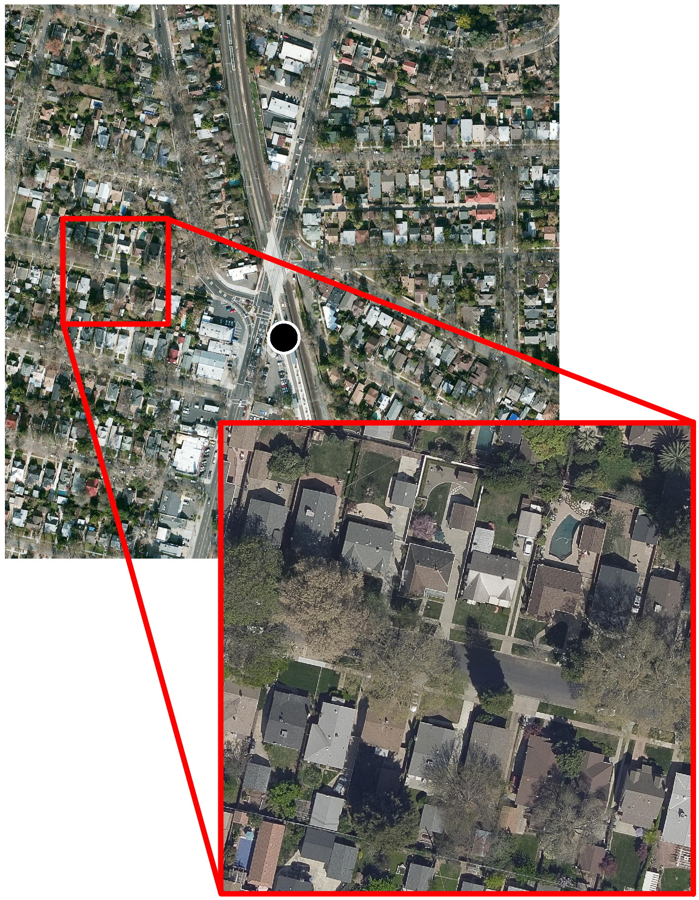
4th Avenue Station
Imagery © Esri
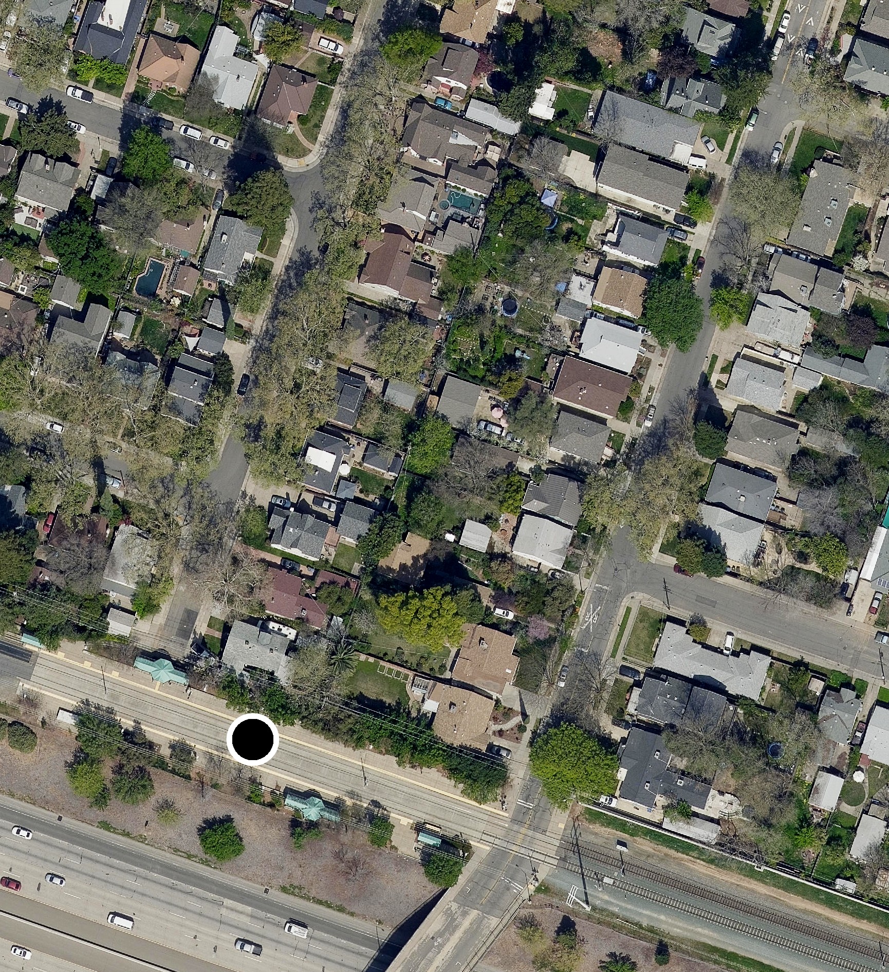
48th Street Station
Imagery © Esri
In these places transit is an exclusive service, with relatively few households and other destinations within walking distance due to the sprawling nature of single-story, single-family detached homes with large lawns and an abundance of on- and off-street parking. Typically these stations will serve only about 100-200 single-family homes accessible within a 1/4 mile walk. This radius when developed as suburban sprawl has the capacity to generate only about $4M / year in property tax revenue for the county. The same exact acreage, using Midtown as a reference, could theoretically support 3-5x as many households complete with a full array of everyday amenities, destinations, and jobs, all while generating twice the property tax revenue, or an additional $4M / year.
3. Light rail stations surrounded by industrial land uses
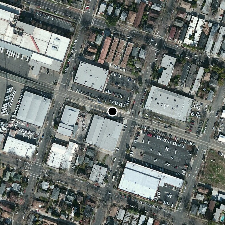
Imagery © Esri
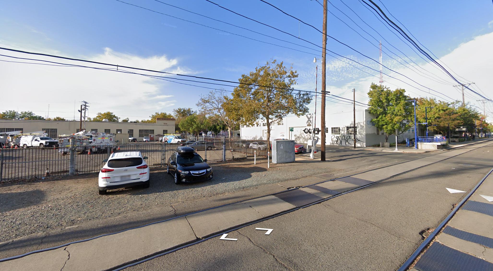
Image © Google
Locating transit stations along Midtown’s only major industrial corridor may have resulted in the poorest possible transit ridership metrics in an otherwise dense urban setting. A stone’s throw from 23rd Street is an AT&T equipment storage lot, a couple unmarked warehouses, and gravel sidewalks—hardly a bustling city street with midtown vibes and eyes on the street providing a sense of safety that many feel is lacking at SacRT stations. I’ll spare the property tax revenue comparison this time because I want to acknowledge that we do need some industrial land use. However, it is a land use that is fundamentally incompatible with high frequency public transit if the goal is to actually get people to use it.
No Return On Investment
SacRT has some of the lowest ridership per mile statistics in the nation, and it only takes standing outside some stations to understand why. Any light rail station surrounded by parking lots, segregated land uses, low-density suburbs, industrial lots, and/or vacant lots represents a significant investment into a neighborhood which has failed and continues to fail to produce adequate returns by all metrics:
- Ridership and social value suffers when there’s few people close enough to ride transit and few destinations near transit. Not to mention transit mode share is a key indicator of success in the 2040 general plan.
- Property tax revenue suffers when the value density and tax base surrounding the stations are so low.
- A small handful of businesses that do happen to be located near transit do not experience a meaningful improvement in sales, resulting in no improvements to sales tax revenue.
- Vehicle Miles Traveled (VMTs) are not meaningfully mitigated, despite its reduction being a key indicator of success in the general plan. High VMTs are associated with significant external costs, including significant direct health impacts in terms of pollution and collisions.
Sacramento Light Rail has not proven itself as a wealth multiplier. These investments were big bets that development intensity would follow, but for 40 years many things have stood in the way of that promise.
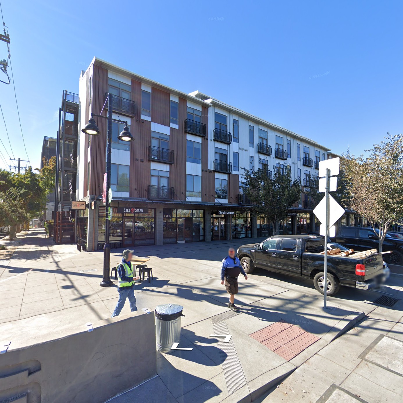
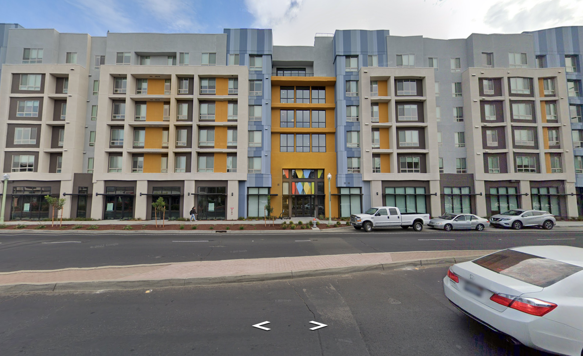
Credit where credit is due
In recent years, Sacramento does have a relatively good track record developing underutilized or vacant parcels within a 1/4 mile from transit. 16th Street Station and 65th Street Station are among the few that are currently exploding with affordable, transit-oriented development:
Images © Google
Meanwhile, however, most other stations in the city are not experiencing anywhere near the same levels of development. In fact, most are completely stagnant. Continue to Part 3 to learn about some factors that get in the way of building towards transit-oriented development.