See our Instagram post here!
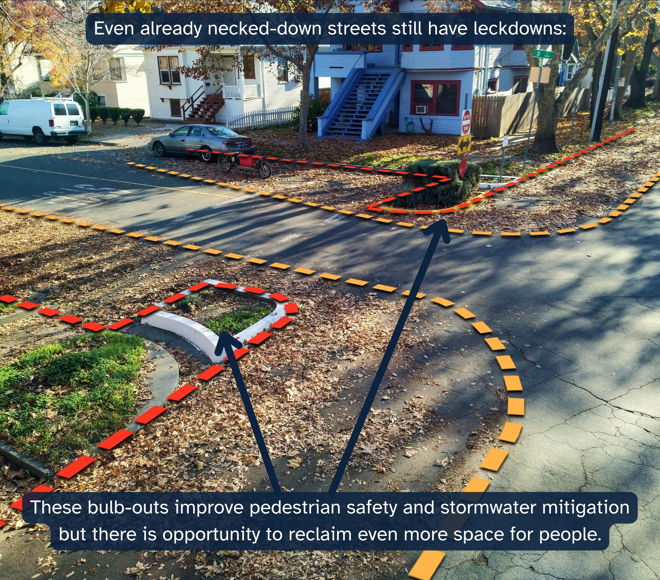
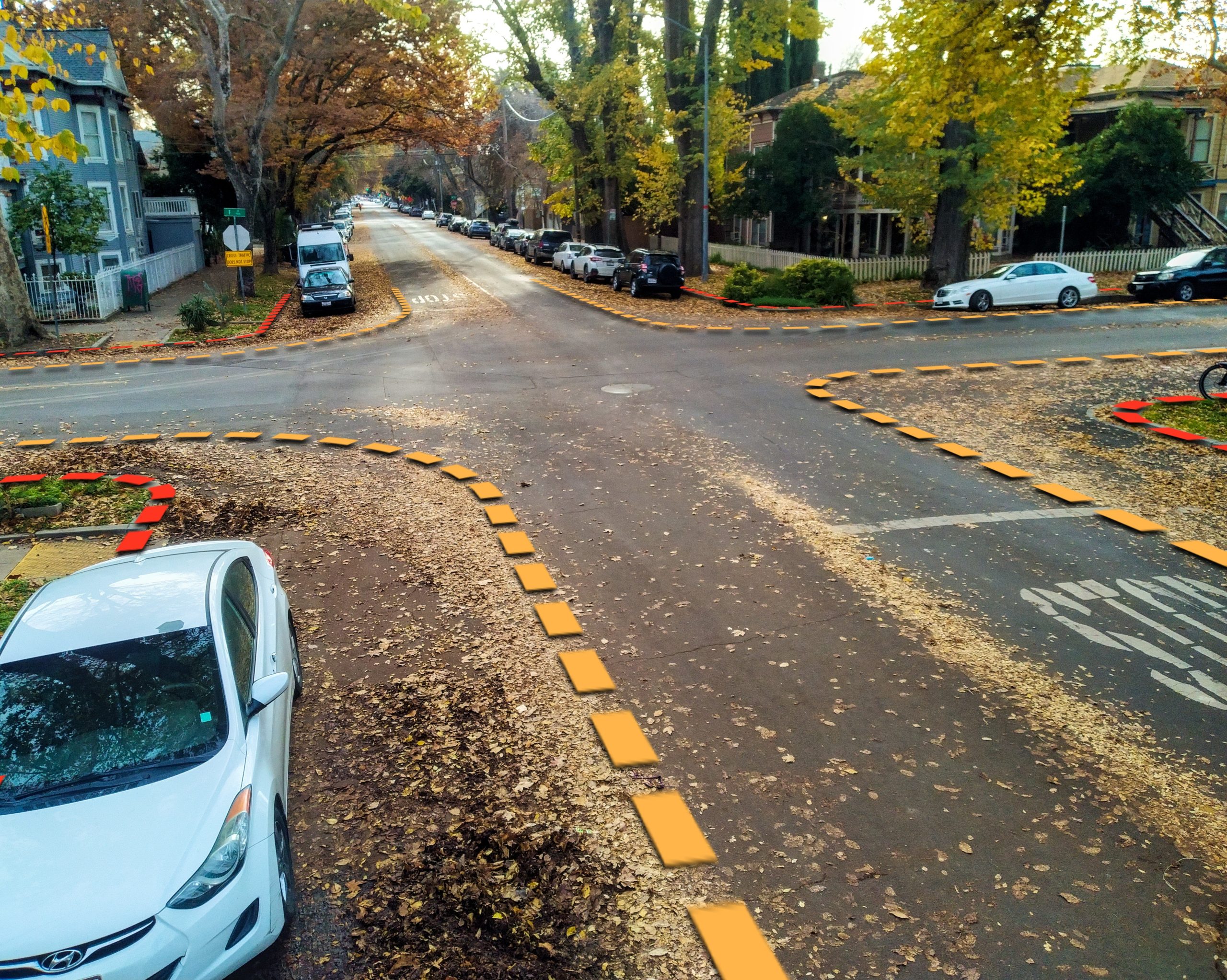
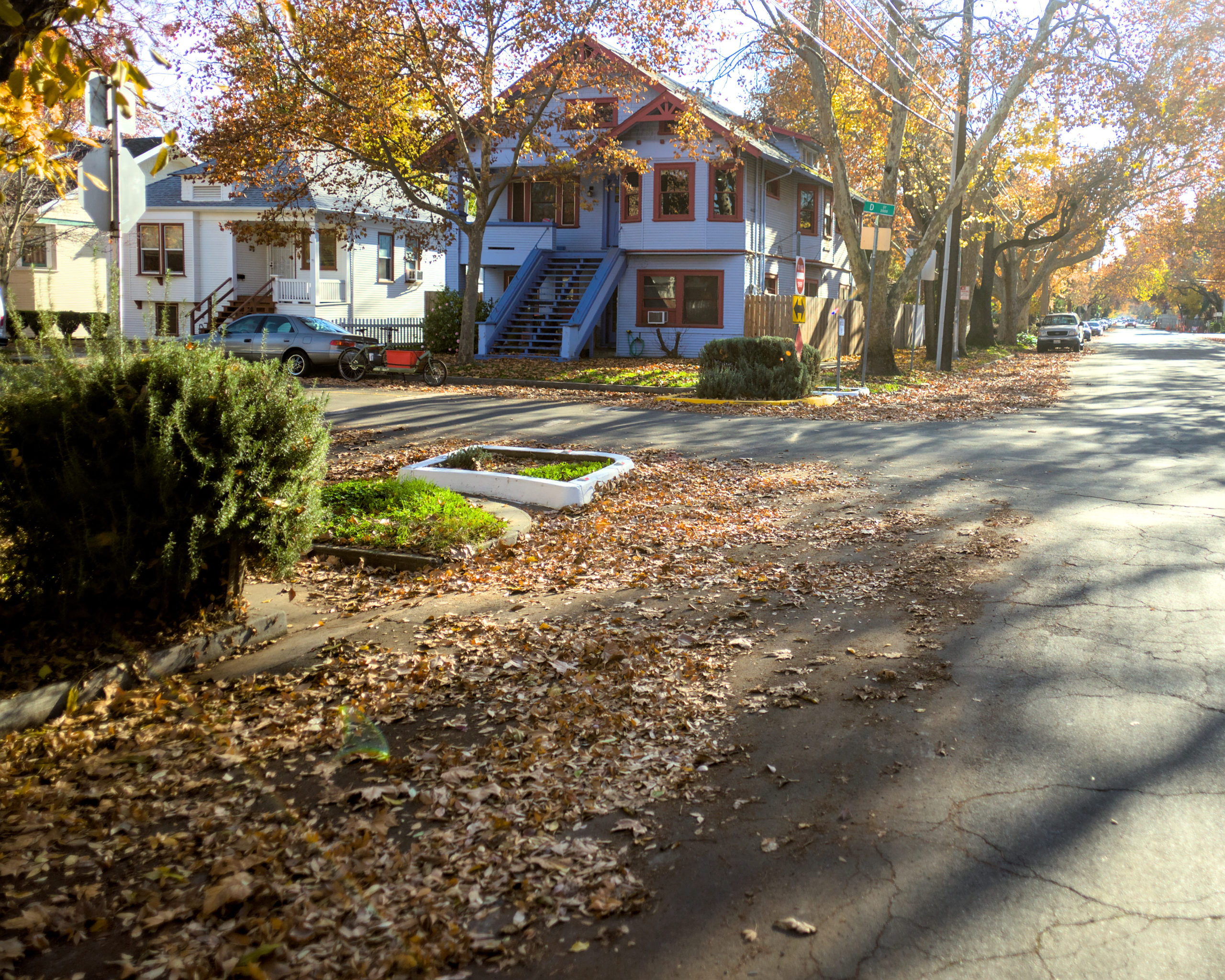
Every fall season, leaves blanket the street, and cars cut paths through them. The remaining patches of leaves effectively “neck down” the street and represent areas that cars do not fully utilize.
We can reclaim this space for more productive and people-centered uses!
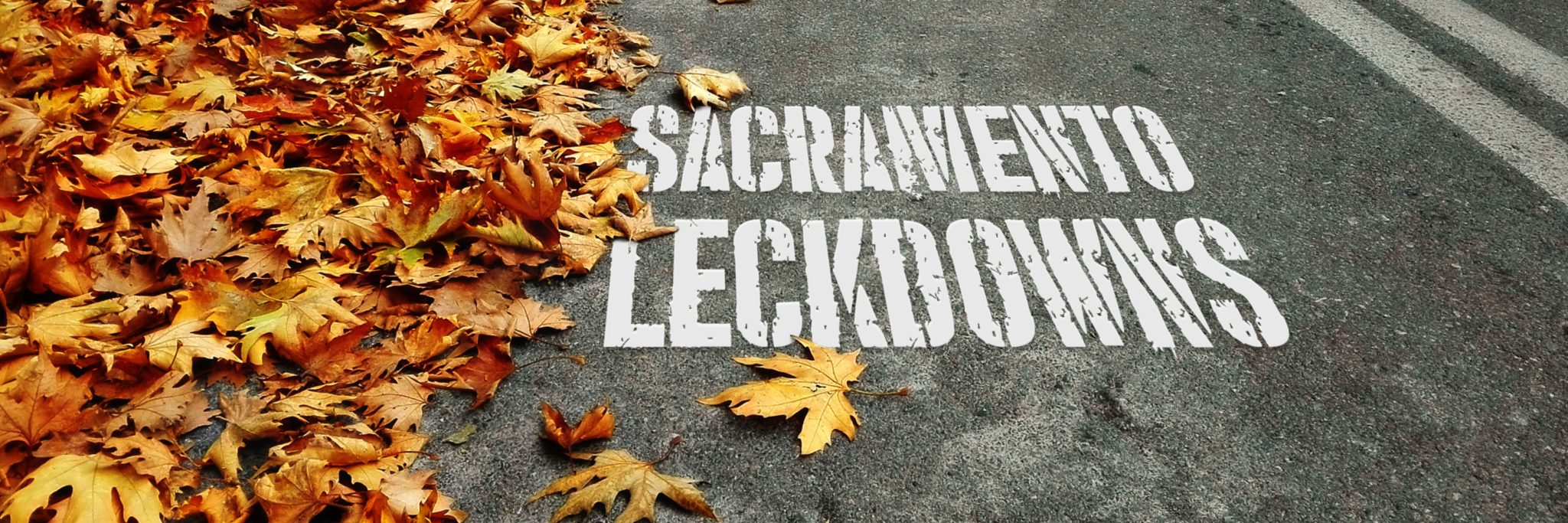
Leckdown Origins: Sneckdowns
In the beginning (2014), we knew only of “sneckdowns”, snowy patches of the street through which motorists and pedestrians alike carved paths. The effect was a necking-down of the street, a form of traffic calming which slows vehicles and enhances pedestrian safety. The term and its hashtag #sneckdowns soon took hold and swept over urbanism social media. People from snowy climates began sharing photos like this one:
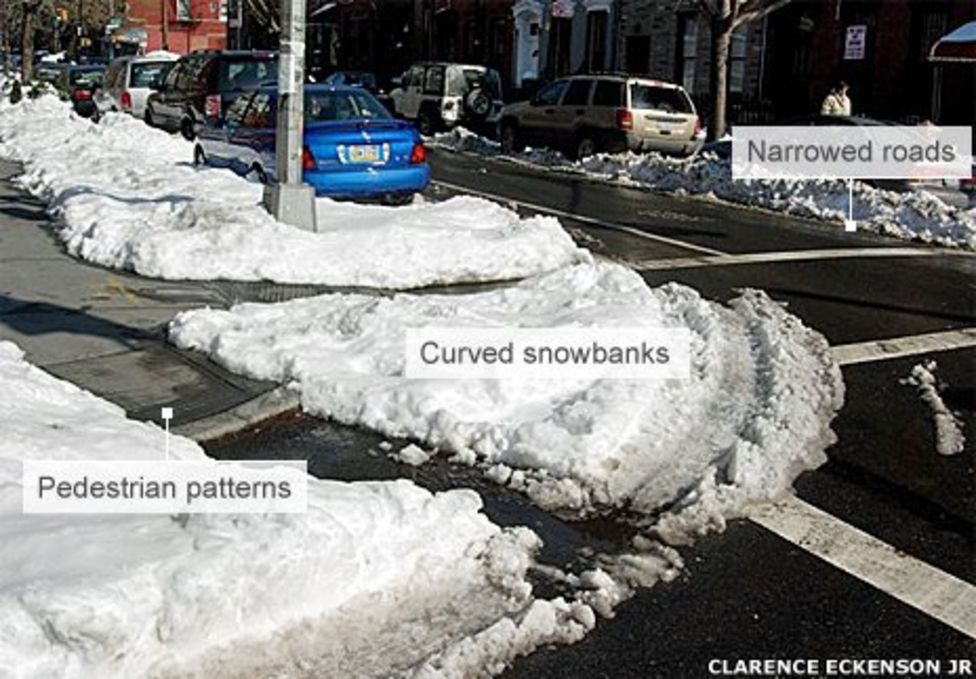
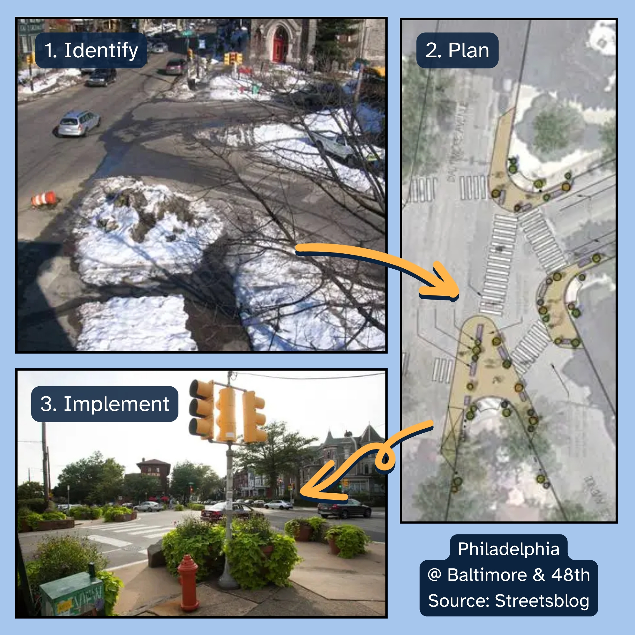
“The snow is almost like nature’s tracing paper,” according to Streetfilms’ Clarence Eckerson. The idea was that you could skip expensive traffic calming studies by simply observing where motorists do not utilize the street, and where pedestrians do. Some planners took the hint, and even reconfigured the streets based on these sneckdowns:
Warmer climates, such as Sacramento’s, unfortunately don’t experience or benefit from this snowy phenomenon. In the 1980s, city planners in Australia threw cake flour into the road to create their own flour-neck-downs, but this is hardly zero-effort like real sneckdowns. Sacramento, City Of Trees, may have another trick up its sleeve.
Sacramento’s Leckdowns
Introducing “leckdowns” or leafy-neckdowns!
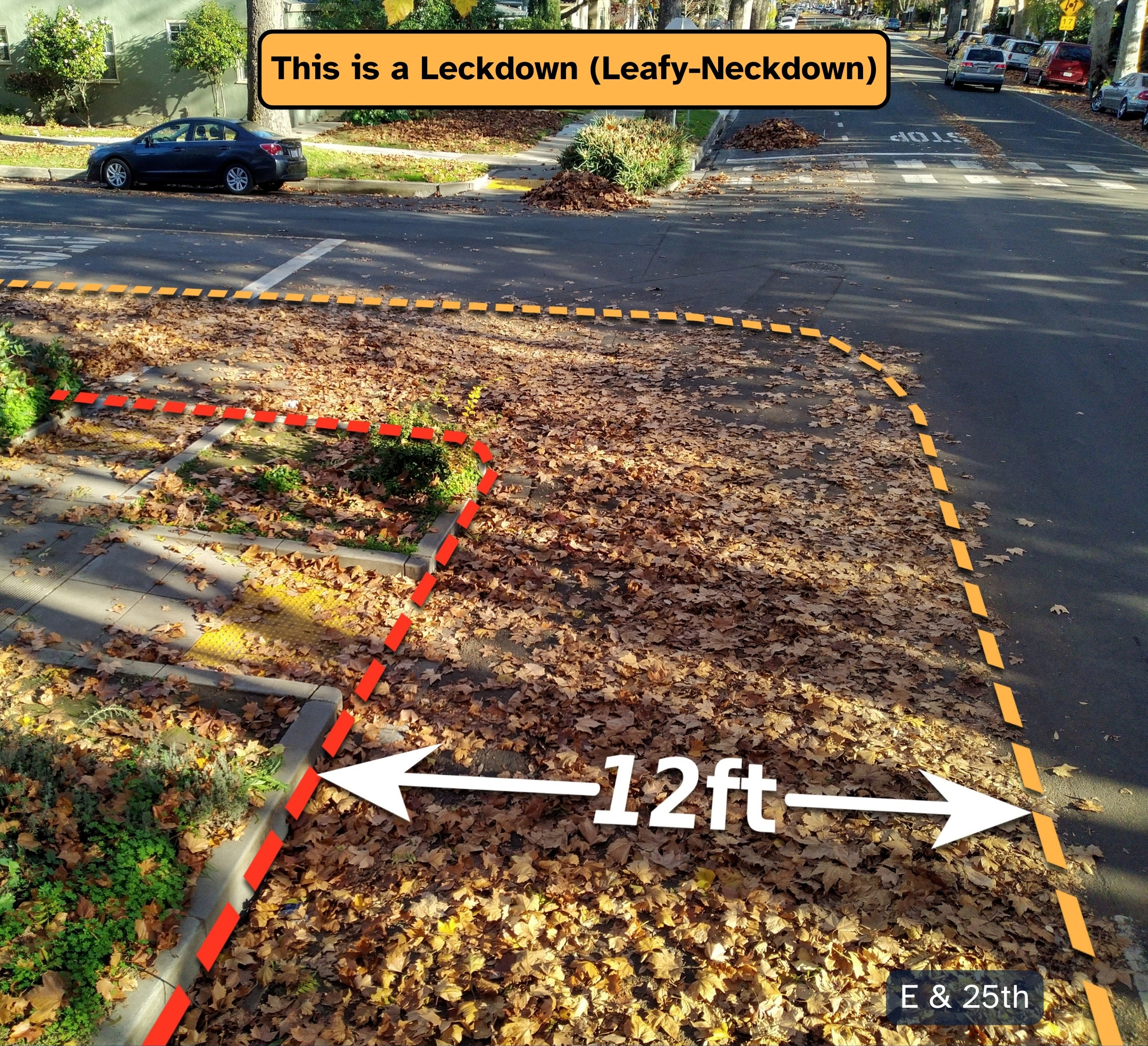
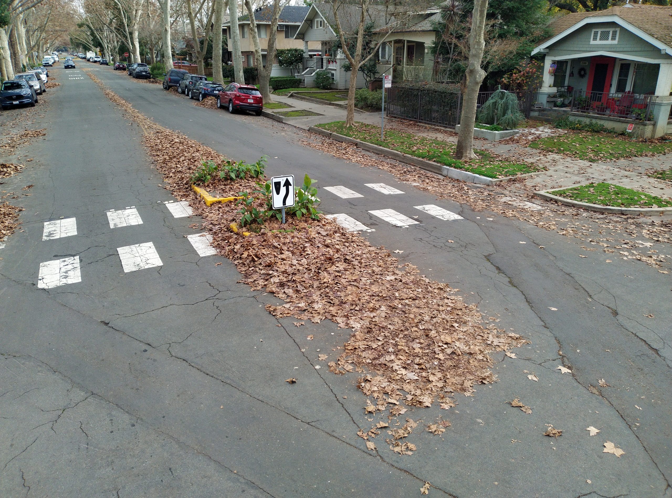
Sacramento’s numerous urban trees deliver our own tracing paper in the form of leaves. That’s right, the leaf litter that blankets our streets (and that we so hastily erase with leaf blowers) effectively conveys the paths of travel for cars, and highlights spaces which are not fully utilized.
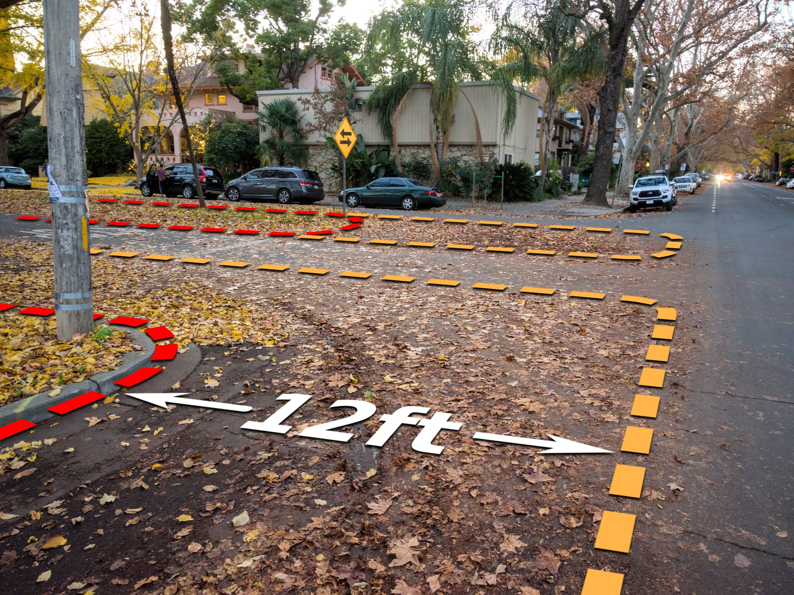
How much space, exactly?
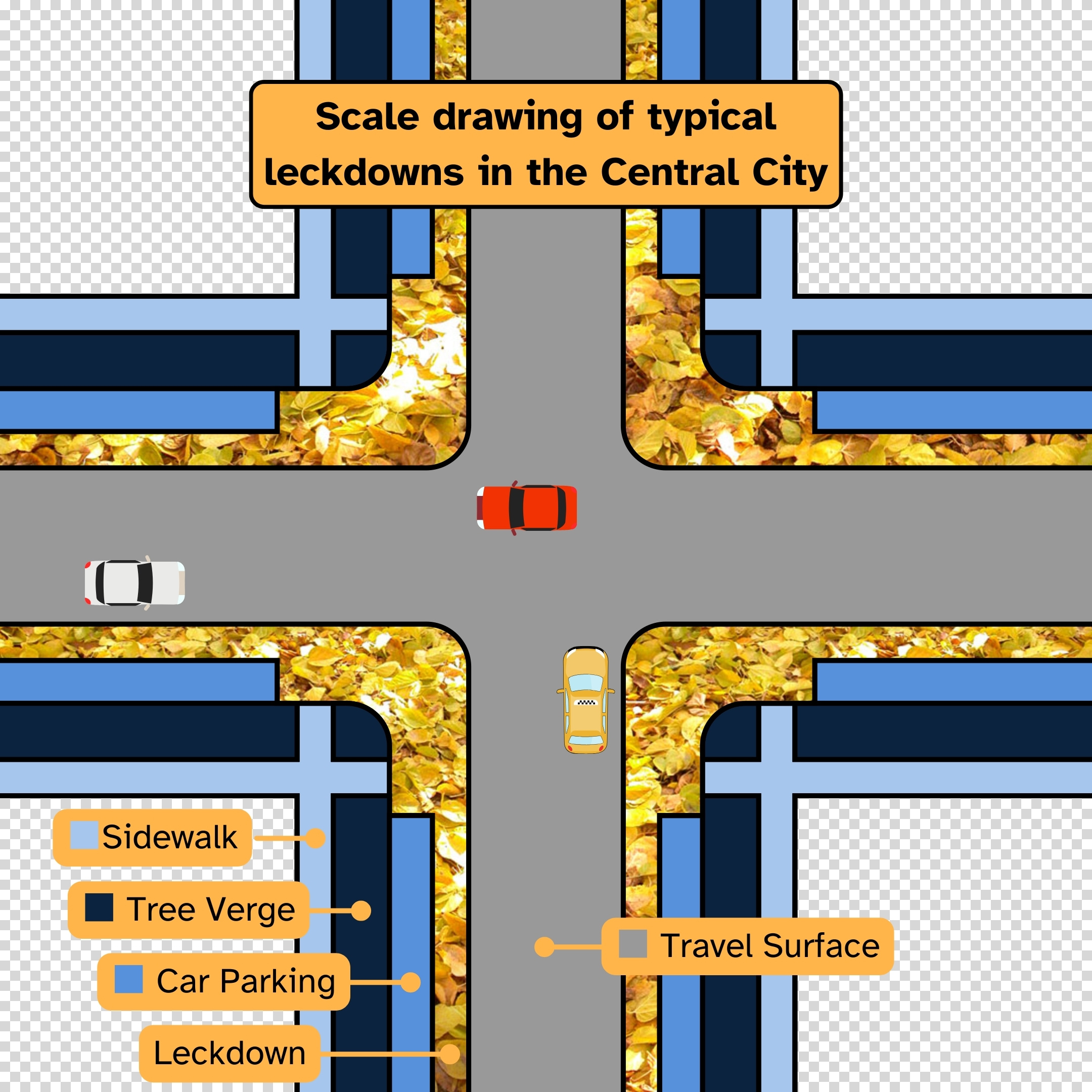
A common Midtown intersection is pictured below; 47ft curb-to-curb width, parallel parking, and 12ft leckdowns. All added up, leckdowns cover 15% of the entire public right-of-way. That’s 9,000 sqft per block otherwise dedicated to wider travel lanes and larger turn radiuses for traveling motorists.
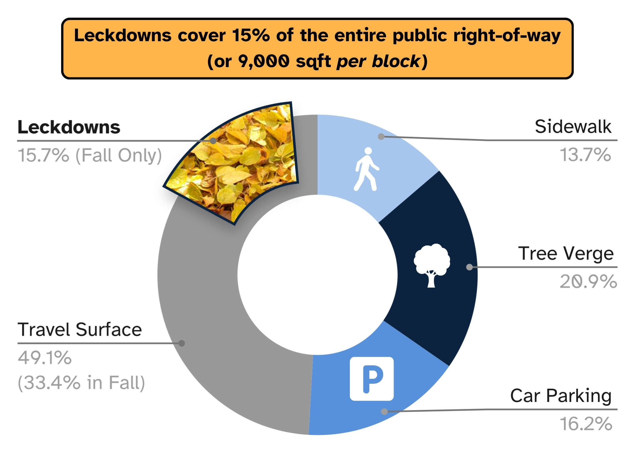
These numbers demonstrate the magnitude of underutilized space currently dedicated for cars, and how much opportunity there is to reclaim some of that for alternative uses.
Land is valuable in Sacramento! Assuming $80/sqft, the land of leckdowns is valued at about $720k per block, or over $300M across the Central City. That isn’t to say that the city should sell this land, but it highlights the absurdity of how planners and traffic engineers have historically valued this land with their actions.
Productive uses of land
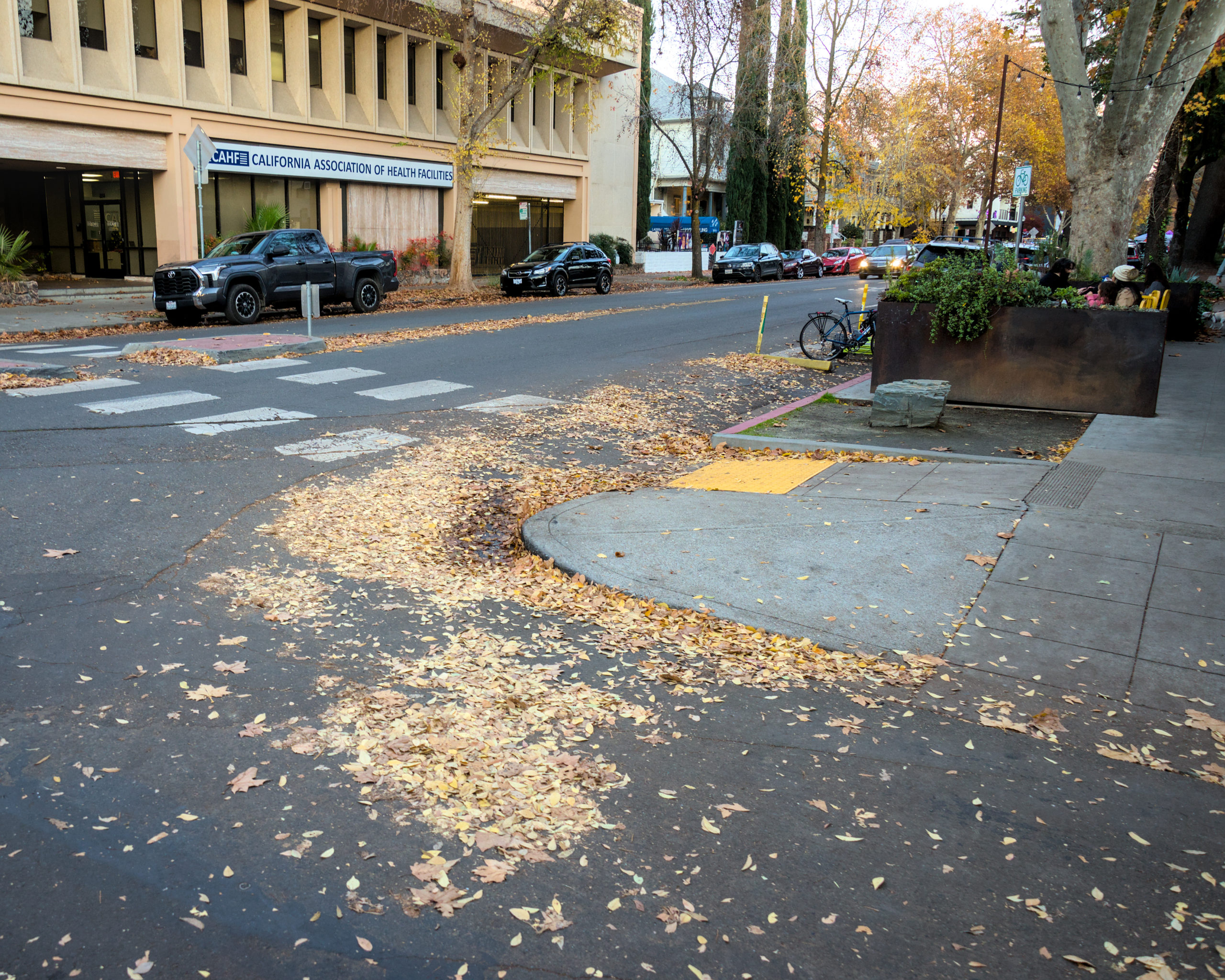
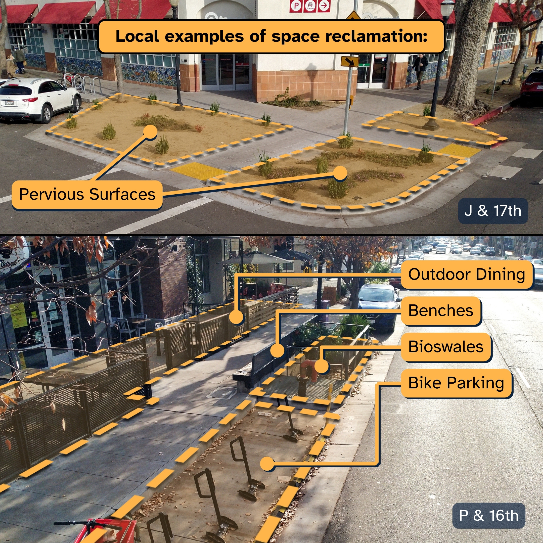
More productive uses of leckdowns includes a combination of people-oriented uses, infrastructural uses, and safety benefits, often overlapping in effect. For example, pervious surfaces planted with trees and shrubs offer a multitude of benefits: facilitates access to nature within an urban setting, reduces water usage by capturing rainwater, mitigates pressure on expensive stormwater management infrastructure, all while improving pedestrian safety by reducing crosswalk lengths and calming traffic. Similarly, outdoor dining, public benches, bioswales, and bike parking facilities all offer combined benefits:
We need not look only to Sacramento to see more possibilities for how we can use more space. Cities all around the world show us how we can make walking a more engaging and productive activity, and even how we can facilitate and uplift other non-car modes of transportation.
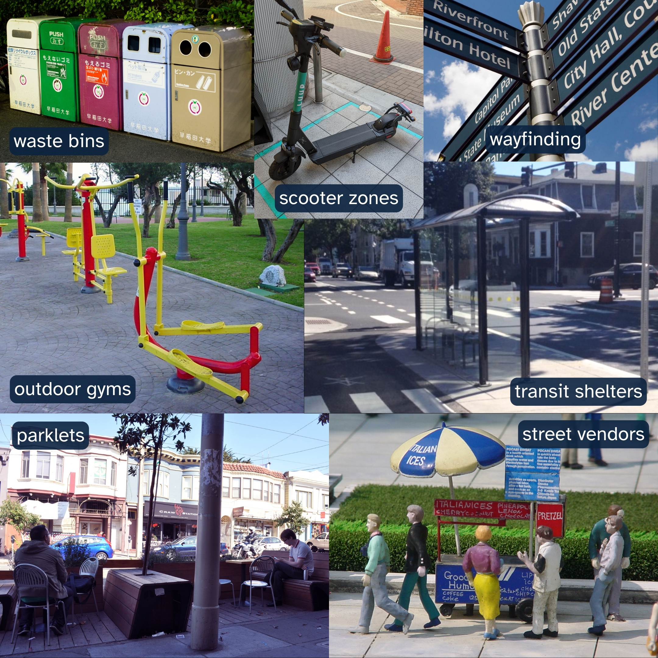
Here are just a few of my ideas:
- outdoor dining
- public benches
- pervious surfaces
- bioswales
- trees
- bike parking
- designated delivery vehicle zone
- designated shared-rideable drop-off zone
- transit shelters
- public art
- street vendors
- outdoor dining patios
- parklets
- mini-playgrounds
- outdoor gyms
- waste bins
- wayfinding signage
- free libraries
- Can you think of more???
An incremental approach
Space reclamation is not free. Doing it right means re-grading, re-locating drains, forming new curbs, re-striping, and installing people-centric amenities; it is simply not in the budget for a city as politically car-centric as Sacramento to reclaim nearly a square mile of leckdowns across the city.
However, an incremental approach is far more feasible. Once again, some of the best examples are local:
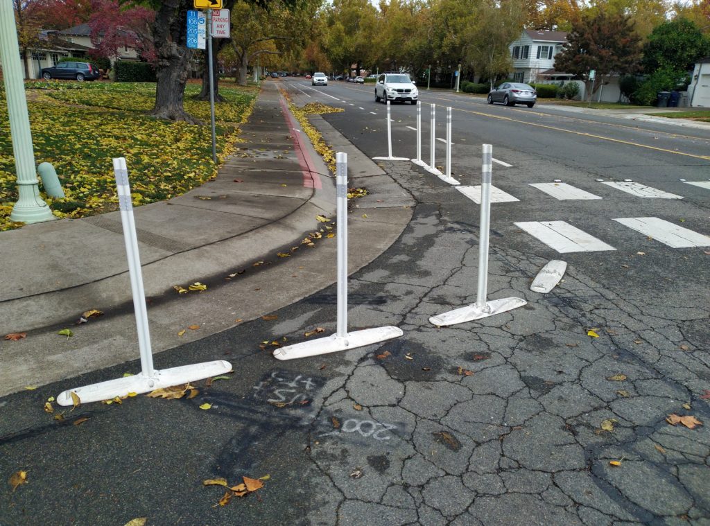
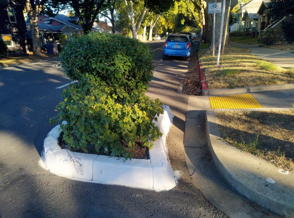
When there’s not enough funding to “do it right” all in one go, just know that there are always cheaper options commonly referred to as “quick-build” or “tactical urbanism”. They may not always yield the full benefit of the real thing, but at least make crossing safer and calm traffic in the meantime.
2024: Year Of The Leckdown
We can incrementally improve the livability of Sacramento by reclaiming leckdowns, and 2024 brings us multiple opportunities to take those steps at the policy level! Sacramento’s official Street Design Standards, Central City Specific Plan, and other area-specific plans are being revised over the next couple years, so stay tuned and be prepared to give your feedback!